Wamkelekile, Welkom
Documenting and preserving African heritage sites
23 September 2020 | Story Anna Kent and Heinz Rüther. Photos Zamani Project team. Read time 7 min.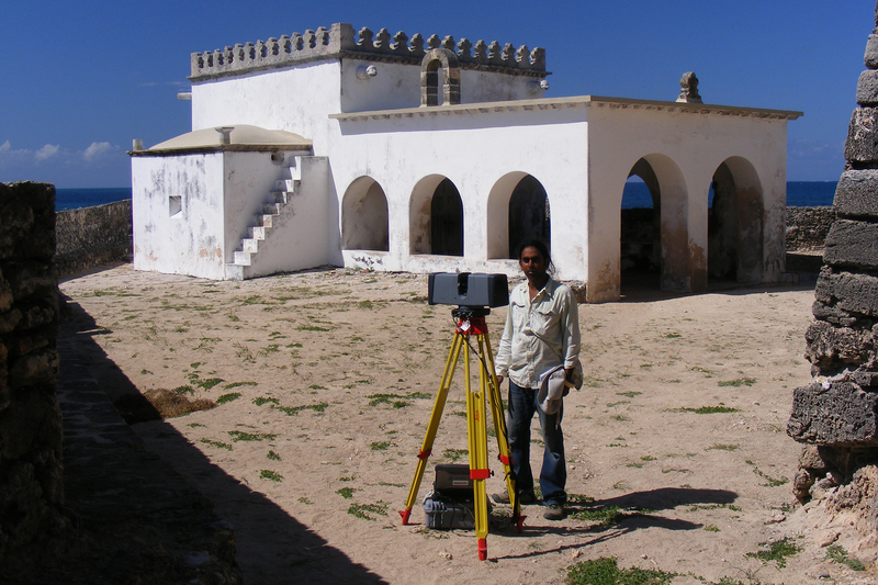
Heritage is the foundation of societies and cultures. The Zamani Project’s repository of accessible, scientifically acquired spatial data of African cultural heritage sites continues to contribute to the University of Cape Town’s (UCT) roots as an African university.
Based in the School of Architecture, Planning and Geomatics in the Faculty of Engineering & the Built Environment, the Zamani Project is a research group that hosts one of the world’s most extensive databases of African cultural heritage sites and structures. This archive has been developed using state-of-the-art documentation technology. As we celebrate Heritage Day on 24 September, we reflect on the value of an accessible, accurate archive of African cultural heritage and describe a few of the African sites that the Zamani Project has documented.
An accessible, accurate archive
With the generous support of the Mellon Foundation, The Saville Foundation, Epic Games and technology from Epic Games and RealityCapture, the Zamani Project has documented more than 250 structures, rock art sites and statues at 65 heritage sites in 18 countries across Africa, the Middle East, Southeast Asia and Europe.
They have created panorama tours, 3D models, Geographic Information Systems, sections, elevations and plans, all of which are accessible on the Zamani Project website and ZivaHub.
“We have a job to do in showing the world the objects of extraordinary sophistication, brilliance, great beauty and technical mastery on the continent and in sub-Saharan Africa.”
Exploring this virtual archive is culturally enriching and informative, allowing the viewer a valuable opportunity to virtually experience cultural heritage sites and structures across Africa and beyond. Stephen Battle, conservation architect at World Monuments Fund, and collaborator with the Zamani Project, reflected on this value:
“The world still has a distorted idea of what Africa is. I come across it all the time … We have a job to do in showing the world the objects of extraordinary sophistication, brilliance, great beauty and technical mastery on the continent and in sub-Saharan Africa.”
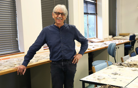
The Zamani Project team, consisting of principal investigator, Heinz Rüther, and chief scientific officers Bruce MacDonald, Ralph Schroeder and Roshan Bhurtha, generates accurate and authentic data, which is highly useful for cultural heritage research and conservation.
Professor George Abungu, a heritage consultant and former representative for Kenya to the United Nations Educational, Scientific and Cultural Organization (UNESCO) World Heritage Committee and former director general of the National Museums of Kenya, explained the value of the Zamani Project’s data:
“It’s extremely important ... We are able to develop very credible research material which contributes to building an accurate understanding, so that we can serve the site through conservation in a truthful way.”
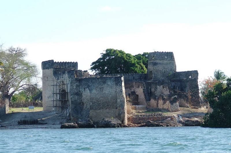
Kilwa Kisiwani: creating awareness of a disappearing site
Located in modern-day Tanzania, Kilwa Kisiwani was a thriving Swahili Coast trading city between the 13th and 16th centuries. Along with nearby island Songo Mnara, it was a central port for Indian Ocean trade in ivory, gold, timber, porcelain, jewellery, pearls and clothing. The oldest standing mosque of the East African coast is situated there. Through its architecture, trade, commerce and rulership, Kilwa Kisiwani and Songo Mnara have been given UNESCO World Heritage Site status.
However, the structures there are deteriorating as wind and rain over the centuries have taken their toll. Sea level rise is now placing the sites in great danger, with some structures already nearly halfway submerged.
As governments are unable to allocate sufficient funds to maintain the structures, heritage specialists must garner support from donors.
Professor Abungu collaborated with the Zamani Project team in their work at Kilwa Kisiwani. He explained that the models created by the Zamani Project team help to interpret what the site would have looked like, which assists in establishing credibility and gaining support from governments and donors.
He further explained that the creation of awareness and appreciation of the cultural heritage sites within the local communities is important in conservation efforts, as materials are often removed from the structures to be used as building material by these communities.
“[Zamani Project’s work] helps in conservation, understanding and creating awareness, from community level to government, to professional level, to the level of donors,” he said.
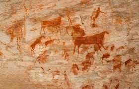
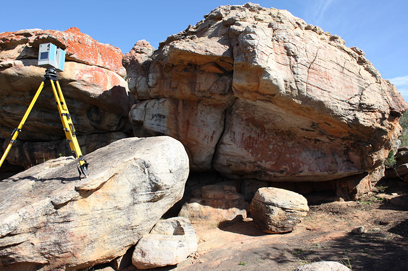
Recording endangered San rock art
Plans by the provincial and national government to raise the level of the Clanwilliam Dam in the Olifants River Valley in the Cederberg, which would flood valuable San rock art sites, led the Zamani Project to document three sites there in 2015 in partnership with their long-time collaborator, Emeritus Professor John Parkington, from the Department of Archaeology.
Parkington is passionate about the importance of documenting the archaeological record to preserve heritage.
“In order to do the history of the people living in Africa we have to do it archaeologically. You can get back a few hundred years on oral traditions and memories … but you can get back millions of years in archaeology,” he explained.
He is an expert on rock art and described how the San rock art in the Clanwilliam caves is probably between 500 and 5 000 years old.
He believes that the spatial framework of the archaeological record is a crucial element in the information that it retains. In the context of the Clanwilliam San rock art documentation project, the spatial record the Zamani Project created was especially relevant for the archaeological record. Because the pieces of the rock art were going to be removed from the caves before the expected flooding, they would have lost their original context.
Parkington further explained that rescuing all the artefacts from the dam waters was not the end of the job: the rock art should go on display for the people of Clanwilliam as the majority of local residents are descendants of the precolonial San who inhabited the area. With Zamani Project’s data it would be possible to make a 3D replica of the site.
What’s next for the Zamani Project?
Although COVID-19 prevented the Zamani Project team from undertaking much of the fieldwork planned for 2020, they have been hard at work processing data to create new digital products, including documentation for the Iziko South African Museum. When travel regulations allow, they plan to travel further afield in Africa and Southeast Asia to document sites in Kenya, Algeria, Petra, Egypt and Myanmar.
Wherever their work takes them, the Zamani Project will continue to provide access to high-quality spatial heritage data, contributing further to UCT’s repository of African cultural heritage and building on the legacy of research excellence in Africa.
 This work is licensed under a Creative Commons Attribution-NoDerivatives 4.0 International License.
Please view the republishing articles page for more information.