Wamkelekile, Welkom
Maintain good water habits – province getting hotter, drier
22 March 2021 | Story Helen Swingler. Photo Getty Images. Voice Neliswa Sosibo. Read time 8 min.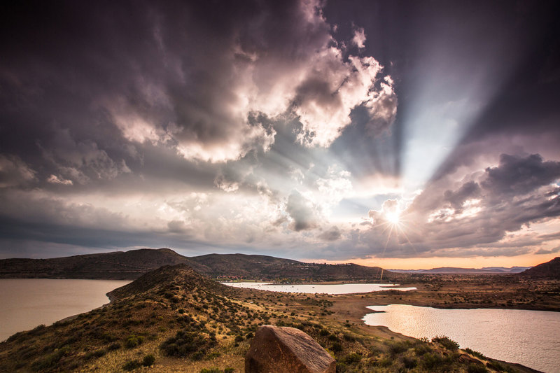
Climate records show that the Western Cape Province’s average temperature has risen by almost one degree over the past 50 years. That trend is set to continue, as climate models predict drier, hotter conditions – with repercussions for water and rainfall, said University of Cape Town (UCT) climatologist Dr Peter Johnston.
And though the province has enjoyed healthy rainfall levels since the “big drought” of 2017/18 – when Cape Town’s major supply-dam levels fell below 13.5%, and the city faced Day Zero – we need to maintain frugal water habits, said Dr Johnston, a researcher in the Climate System Analysis Group (CSAG) in UCT’s Faculty of Science.
“Water is going to become a challenge.”
“Water is going to become a challenge.”
The caution comes on the eve of the United Nations World Water Day, 22 March, with its 2021 campaign theme, “Valuing water”. This annual observance highlights the importance of fresh water and the sustainable management of the world’s freshwater resources. (World Meteorological Day is coming up on 23 March.)
Johnston explained: “Near the end of the 2020/21 South African summer, an assessment of the rainfall (and thus water) situation confirms a mostly above-normal rainfall in the summer rainfall region during this current La Niña episode.”
La Niña and El Niño
La Niña and El Niño episodes are intricately bound to the country’s weather patterns and rainfall.
“The El Niño–Southern Oscillation is a seesaw of pressure variations in the Pacific Ocean that correlate with a likelihood of drier (El Niño) and wetter (La Niña) summers in Southern Africa,” said Johnston.
“So far this summer, stations in Gauteng, the Free State and Limpopo are showing around 100–150% of the expected (average) summer rainfall. The net effect is that dam levels supplying Gauteng are looking healthy.”
But things are not as healthy in the central and southern Karoo and parts of the Eastern Cape, he said, with these regions still struggling with levels of around 70% on average.
“In the Eastern and Southern Cape some dams are still sitting at low levels of around 10%, while there are places in this region that are even worse off than this time last year, having had a 36-month drought. Since their rainfall is mostly expected in summer, unless their winter component is well above normal, their woes will continue.”
The Western Cape enters winter with some early rain having fallen, Johnston said, but this is off the back of scant summer rainfall, well below average (in the case of Cape Town, 53% of its summer average).
“There is little evidence of a positive contribution for winter rainfall from La Niña in this region.”
Rain ahead
“CSAG will be monitoring the rainfall during the winter, though the state of our dams is currently better than it has been for the past five years. By the end of May we will be able to predict statistically whether we will have a wet year.
“It’s important to realise, though, that the rainfall averages for Cape Town (central) are 29 mm (March), 66 mm (April), 111 mm (May), 139 mm (June), 126 mm (July), 114 mm (Aug) and 73 mm (September). The airport station expects about 30% less than these averages, and Kirstenbosch about 60% more.”
During a recent CapeTalk radio show, host Refilwe Moloto asked Johnston about weather variability this summer. Had the summer been milder than usual?
“We forget that Cape Town has quite a variable climate, with frequent droughts.”
“Two things we must always remember is that there’s a high degree of variability every year, and no two years are the same,” said Johnston. “And secondly, it isn’t always about perception … we need to look at the records. If we look at last year, for example, it might surprise you that six months were warmer than normal, and six months were cooler than normal.
“If you look at the rainfall, it was pretty much normal last year. So, when we look at this year’s data, we see January was drier than normal, and February was drier than normal. January was warmer than normal, and February was cooler than normal – but not much cooler – less than a degree – on average.”
People remember the extremes of the seasons, Johnston noted. This weather volatility is the nature of what climatologists call the “shoulder season”, subject to both the summer and the winter synoptic systems.
“We forget that Cape Town has quite a variable climate, with frequent droughts.”
And what about expected winter rainfall?
“So, clearly that’s a huge question,” said Johnston. “To put it into context, we have had a series of droughts, and we have recently had a sequence of normal years and even some wet years.
“And just thinking about it, one could say we are due for another drier year. And is this going to be a problem? Well, our dams haven’t been fuller, so to speak, because we had 100% in November, December. We are well poised to outlast the dry summer. So that’s not really a worry for us at this stage.”
In terms of longer-term forecasts, Johnston said that it was hard to speculate, given that climate models were not very ‘skilful’ for this region.
“There are three big forecasts out there: one is saying that there is no indication of anything but normal; another one is suggesting that it looks like early winter is going to be slightly drier. And the third one suggests that we are probably looking at a slightly wetter winter,” he said.
“If we get a normal winter, that’s fine. If we get a slightly drier winter, that’s also okay, provided it’s not followed up by another two dry winters.”
Not a drop to spare
Though the water situation is far from critical now, Johnston cautions against complacency.
“So, our water situation is not going to improve. It’s just a temporary situation; a temporary reprieve.”
“The long-term scenario is that Cape Town is likely to get drier, and it’s very likely to get hotter too. And we’re going to have more people [moving to the city]. So, our water situation is not going to improve. It’s just a temporary situation; a temporary reprieve.”
And as the temperatures rise, so will the impact on agriculture and on water evaporation.
“Having taken that into account, we have not been able to detect a very significant change in rainfall, because our rainfall is so variable … And the reason for that is that we depend on the frontal systems that bring us our rain, and they’re generally unpredictable in the medium term.”
This is because of the presence and influence of high-pressure systems that lie over the southern tip of the continent, said Johnston.
“If they push fronts northwards during autumn and winter, fronts can come our way and we get rain. Depending on their position and strength, they can also deflect the fronts to the south, with little or no rain. And we have evidence that the South Atlantic high-pressure cell is increasing in strength; and that doesn’t augur well for the frequency of fronts in the future.”
Water conservation, planning and management will become more important.
“We must make sure that we use our water wisely. And we must continue to heed the warnings of global climate model projections showing a tendency for drying in the south-western Cape, together with an assured increase in temperature, the combination of which will increase our vulnerability to drought.”
 This work is licensed under a Creative Commons Attribution-NoDerivatives 4.0 International License.
Please view the republishing articles page for more information.